What is CHRMAP
Our coastlines are constantly changing – from natural events, climate change and from the presence of built infrastructure. The Shire’s coastline is highly valued for its natural environment, landscape and sandy beaches. Within the Shire, Hopetoun beaches are amongst the most visited.
The Hopetoun region has been identified as an ‘erosion hotspot’ (where coastal erosion is expected to impact on public and private physical assets within 25 years). Therefore, the Shire is developing a Coastal Hazard Risk Management and Adaptation Plan (CHRMAP) to understand ‘coastal hazards’ and ‘risks’ that may impact the coastline in the future and what the options are for managing those.
The State government’s Coastal Hazard Risk Management and Adaptation Planning Guidelines (July 2019) provide guidance for decision makers to develop and implement effective CHRMAPs
There are four main adaptation options for managing coastal risk.
- Avoid
- Planned or managed retreat
- Accommodate
- Protect
Different options are appropriate for different locations taking into consideration the type of coastline, community values, environmental impacts and cost implications.
Click on the video below to find out all about this project.
Get Involved!
The Shire has now completed an assessment of risk and vulnerability for the coast of Hopetoun.
During the assessment, which comprises Stages 1-5 of the CHRMAP (see Project Timeframes below) the Shire has identified assets within Hopetoun that may be subject to coastal erosion and inundation over the next 100 years.
The hazard maps for erosion and inundation, and the map showing the assets at risk over the 100 year time frame can be found at each of the links attached or in the document library below.
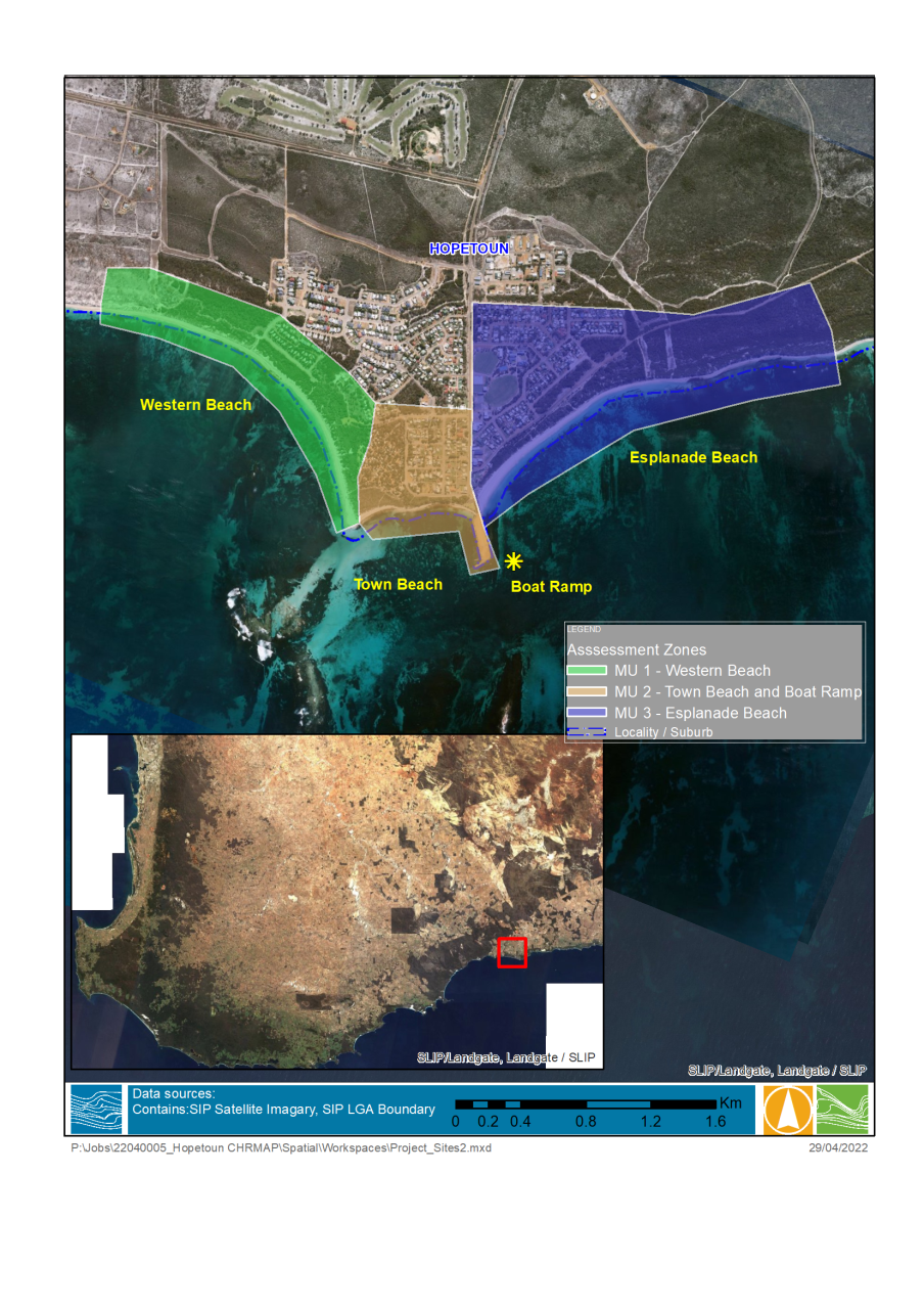
The coast was divided in three management units to facilitate the study.
MU1: Western Beach
MU2: Town Beach and Boat Ramp
MU3: Esplanade Beach
To reach this stage the project team has used the outcomes from the previous engagement and technical assessments. To make sure we understood your values accurately, we need to understand your thoughts on the adaptation options that are suitable to the area and reflect the values that you told us previously.
A brief survey link is included below and is open from Friday 16 June 2023 to Friday 14 July 2023. The information from the survey will be used to complete the adaptation plan to enable the Shire to plan for the future of coastal hazards over both the short and long term. It is recommended that you refer to the hazard maps and assets at risk whilst you are responding to the survey.
Survey
If you require a hard copy survey, please contact Shire’s project manager, Natalie Bell on (08) 9839 0000 or pm@ravensthorpe.wa.gov.au
The final engagement opportunity for this project will be commenting on the draft CHRMAP – scheduled for later in 2023. Information will be made available on this webpage.
To keep up to date with the project please provide your details at the following link.
https://www.surveymonkey.com/r/HopetounCHRMAP
It should be noted that there are ongoing technical assessments underway, including geotechnical investigations, which may result in lower levels of vulnerability along the coast than currently predicted. These are being undertaken to ensure coastal hazard planning uses to most up-to-date information, and reflects the Shire’s commitment to a safety and risk management approach that continues to allow for use and enjoyment of the coastline until such time as impacts are experienced.